 Fleet Manager
 TOOLS & EXTENSIONS
.png?width=1200&height=675&name=BB%20Support%20(1).png)
.png) ENGINEERING
ENGINEERING
.png)

.png) COMPANY
COMPANY
.png?width=1200&height=674&name=Bastian-Solutions_BlueBotics%20(1).png)

ANT everywhere allows AGV makers to address many new applications, however two key use cases stand out:
- Moving payloads between buildings (often required, for example, in the case of steel and aluminum production).
- Moving payloads between logistics & production sites (in industries such as tire production, logistics and production operations are often housed in separate, unlinked buildings).


Aerospace

Airports

Automotive

Agriculture

Mining

Paper & Pulp

Metal

Wind turbines/offshore

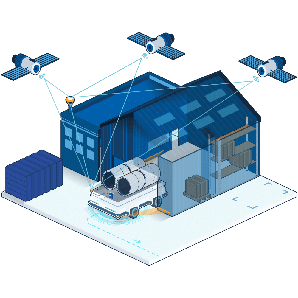
ANT everywhere - Enabling a new era of AGV & AMR operations
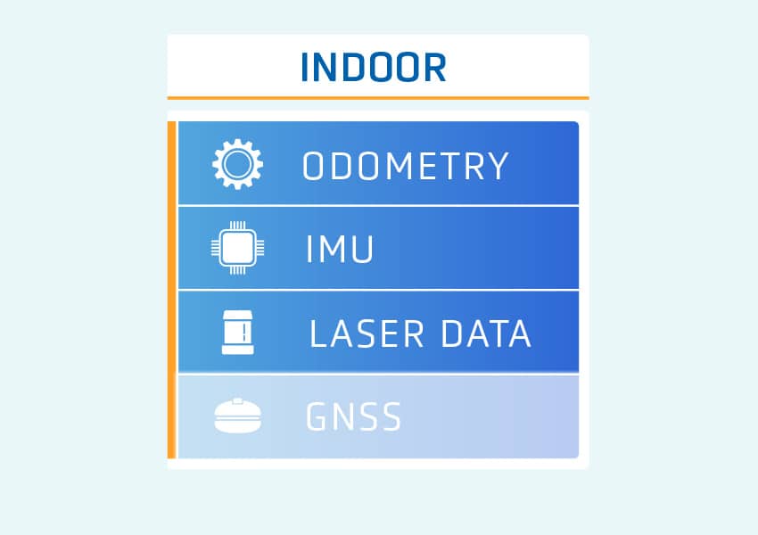
1 | All sensors run simultaneously
All of ANT’s sources of positioning data (odometry, laser data, IMU, and GNSS with RTK positioning) run concurrently, called sensor fusion. ANT then employs whichever data is the most relevant.
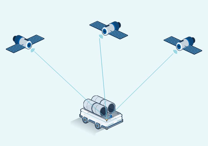
2 | GNSS signals received by vehicle
Each ANT everywhere vehicle features a GNSS receiver, which receives GNSS positioning data directly from satellites.
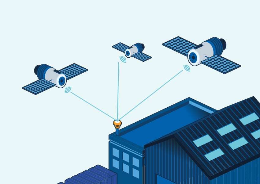
3 |
Fixed base station sends corrections
(e.g on roof of building)
A fixed base station – installed on-site - also receives positioning and timing data from GNSS satellites. This base then sends ‘corrections’ to this GNSS data to the vehicle's ANT everywhere receiver, transforming GNSS’ usual accuracy of around 3 meters to approximately 1 centimeter.
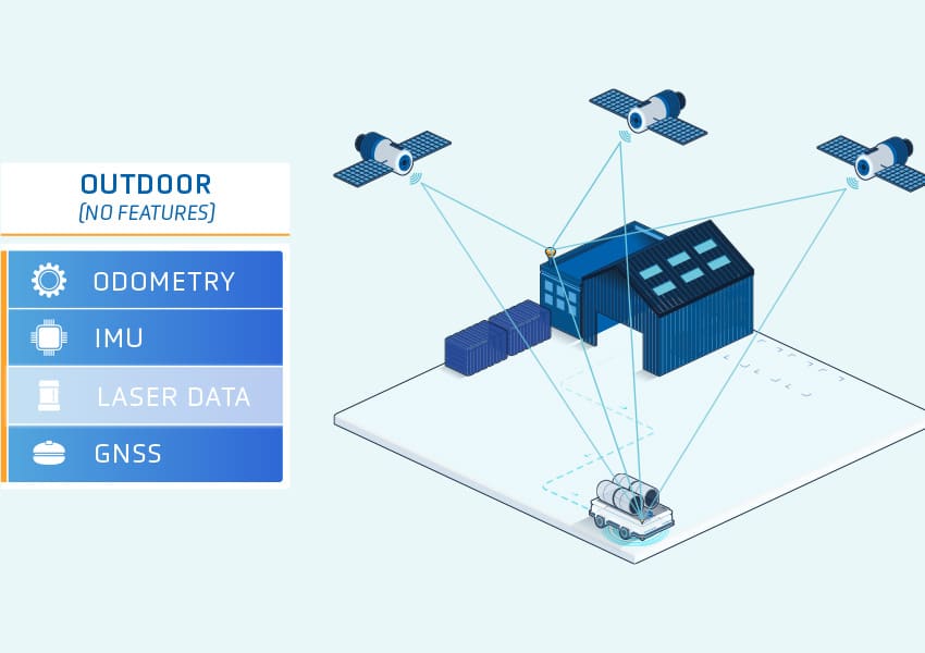
4 | ANT fuses all available data
ANT employs whichever data (GNSS, laser etc.) is the most relevant at the time.
Components & Compatibility
- ANT everywhere base station (1x per site)
- ANT everywhere receiver & software extension (1x per vehicle)
- ANT everywhere Support Package (mandatory for 1st installation)
- Compatible with: ANT lite+, ANT localization+, ANT localization
